Norton, M.U.R.P. alumni explore funding methods for Michigan water trails in new report
A team of Taubman College alumni from the Master of Urban Planning program has published a report from their 2023 capstone project, led by Professor Richard Norton, in the Journal of Environmental Planning and Management. Titled “Running the River,” the article proposes changes to Michigan law to make it easier to fund improvements and maintenance for water trails in the state.
M.U.R.P. ’23 graduates Kat Cameron, Catherine Carlberg, Marco Dominguez, Nida Khan, Luke Ranker, Olivia Stillman, Alex Wilkinson, and Elsa Soderberg completed the report as part of their final capstone studio. Taken in the final semester of the program, capstones provide students with unique, client-based experiences that mirror real-world projects.
For their project, the group partnered with the Shiawassee River Water Trail Coalition, an organization promoting the use and preservation of the Shiawassee River water trail. “Running the River” proposes using tax increment financing (TIF) as a novel strategy to fund improvements to infrastructure along the water trail. Primarily used to redevelop blighted areas, TIF districts divert future increases in property tax revenue to subsidize improvements intended to raise local property values. According to the report, TIF has not been used to improve recreational areas.
Norton, professor of urban and regional planning, holds a joint appointment in the School for Environment and Sustainability. His research focuses on planning law, environmental planning, and coastal area management.
Read the full report on the Taubman College website. Read the published article in the Journal of Environmental Planning and Management.
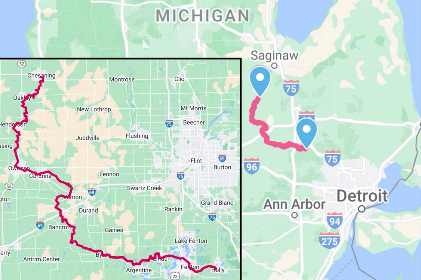
Main Image: Image of the Lower Peninsula of Michigan showing the location of the Shiawassee River Water Trail running from Holly northwest to Chesaning, with an inset showing more detail. Source: Google Map Data, 2024.