


Design and Spatial Justice
Design & Spatial Justice focuses on how architecture, urban planning, and design can be mobilized as tools for advancing equity, supporting social movements, and transforming the conditions that produce spatial inequality. Rather than treating design as a neutral or purely aesthetic practice, the cluster approaches with the understanding that it is shaped by and shaping systems of land ownership, governance, infrastructure, and access. Through interdisciplinary collaboration and community-engaged research, the work centers the knowledge, experiences, and leadership of communities most impacted by injustice, while developing new frameworks, tools, and spatial strategies that contribute to more just and collectively determined futures.
How to Engage
For Collaborators and Partners
Design & Spatial Justice engages collaborators who are working to transform the systems that shape land, infrastructure, and the built environment. The cluster partners with community-based organizations, public agencies, designers, and policymakers to support ongoing struggles for housing justice, equitable development, and environmental resilience. Whether you’re interested in collaborative research, pilot projects, or applying design to spatial justice challenges, reach out to individual faculty or affiliated teams to explore opportunities.
For Prospective Students and Research Assistants
Design & Spatial Justice faculty at Taubman College offer opportunities to engage in research at the intersection of design, equity, and community well-being. Students may work alongside faculty on projects related to housing equity, transportation access, land ownership, and community-engaged design. Explore faculty work, lab groups, and ongoing initiatives, and reach out directly if you’re interested in contributing.
For Funders
Support enables interdisciplinary research, community-based projects, and the development of design interventions that address urgent spatial justice challenges. Funding contributes to student research, fieldwork, prototyping, and the translation of research into policy, tools, and public-facing outputs. We welcome partnerships with foundations, public agencies, and organizations aligned with advancing equity through design and planning.
Research Scope & Societal Relevance
- Understanding land ownership as a foundational driver of spatial inequality — including collective, community, and non-speculative models of landholding practiced by communities of color and indigenous peoples.
- Examining how transportation policy reproduces racial and economic disparities, and advocating for investments that prioritize access for marginalized travelers.
- Investigating the barriers facing low-income homeowners and rehabbers, and developing tools and resources to support equitable pathways to homeownership.
- Exploring how architecture and urban design can actively support social movements working toward decolonization, climate justice, and community self-determination.
- Developing design methodologies — from board games to spatial capacity tools — that extend knowledge to housing nonprofits and community organizations.
- Bridging traditional ecological knowledge and contemporary science to address environmental justice, including indigenous relationships to land and water.
People, Teams, and Partners









Constellations of Projects & Methodologies
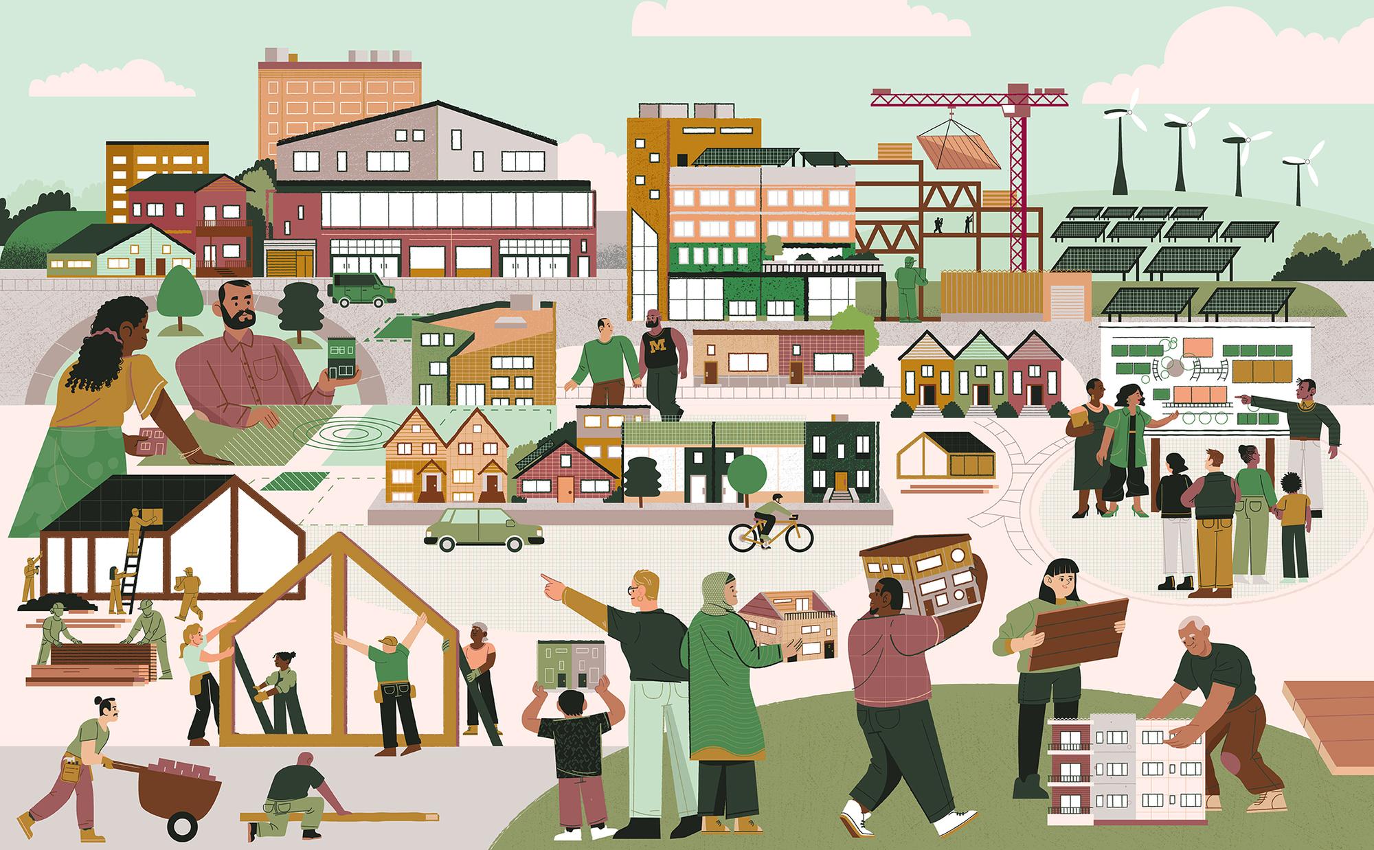
Design & Spatial Justice is defined by projects that challenge dominant development models by foregrounding equitable infrastructure, non-speculative land practices, and alternative governance structures. They extend design beyond traditional outputs, producing tools, archives, and public-facing work that make spatial knowledge accessible and support communities in reshaping their environments.
Manoomin Restoration & Indigenous Land-Water Relations
In collaboration with U-M’s Botanical Gardens and School for Environment and Sustainability (SEAS), this project investigates the restoration of manoomin (wild rice); a foundational source of nutrition for Anishinaabe people in Michigan. The growth of manoomin has been disrupted by changes in watershed conditions and the project bridges traditional ecological knowledge and contemporary science to explore how design and planning can support ecological and cultural restoration. Supported by an NCID Bowman Center grant.
Detroit Land Bank Authority: Equitable Homeownership Tools
Working with the Detroit Land Bank Authority, this project studies the barriers facing people who purchase vacant, dilapidated properties at nominal cost and must rehabilitate them to achieve full legal ownership. Drawing on surveys of nearly 200 rehabbers, the research develops practical tools and resources focused on weatherization and energy efficiency. The project’s longer-term goal is to use findings to teach community members how to rehab buildings sustainably. Supported by NSF and university funding.
Housing Nonprofit Capacity Building: Spatial Thinking Board Game
A capacity-building tool designed as a board game for housing nonprofit organizations, extending spatial thinking and design knowledge to help these organizations advance their missions. The project reflects a broader commitment to developing non-traditional design products that put architectural and planning expertise directly in the hands of community-based organizations.
Shared Land Ownership Practices
Research examining collective and shared land ownership practices cultivated by Black churches and minority communities — bringing these often-overlooked models to the surface as meaningful contributions to urban design and property law. This work challenges conventional frameworks and advocates for the recognition and support of shared ownership as a viable model for equitable city-building.
Race, Transportation, and Access
Current work with U-M Civil Engineering partners focuses on developing survey instruments that better capture the needs and experiences of traditionally disadvantaged travelers.
Passive Cooling & Infrastructure Justice in Informal Settlements
This project examines how climate-responsive design can improve living conditions in informal settlements by focusing on passive cooling strategies, infrastructure access, and the right to housing. Grounded in the study of self-built homes, the research analyzes how residents construct and adapt their dwellings under conditions of heat stress and limited resources, using these practices as a basis for proposing low-cost, scalable interventions. Emphasis is placed on enhancing thermal comfort through material choices—such as reflective roof coatings—and construction techniques that increase airflow and reduce solar heat gain, with environmental simulations used to test and refine these strategies. At the same time, the project situates design within broader questions of equity by addressing disparities in access to clean water, sewage systems, basic infrastructure, and security. By linking environmental performance with social and spatial justice, this work advances design approaches that support more resilient, dignified, and equitable forms of housing.
Neighbourhood Action Tables — Building Local Governance Infrastructure
This initiative centers on Community Development Advocates of Detroit’s Neighborhood Action Tables (NATs), which convene residents, institutions, and local stakeholders to collectively identify priorities and drive neighborhood-level decision-making. Through recurring monthly meetings and structured facilitation, the project strengthens social infrastructure by redistributing influence to community members. By creating sustained spaces for dialogue and collaboration, NATs reframe participation as an ongoing practice rather than a one-time engagement, positioning neighborhoods as active sites of governance and design.
Community Development Ecosystem — Cross-Sector Coalition Building
Positioned as one of the largest coordinated efforts of its kind in the United States, this project focuses on building a national ecosystem that connects banks, nonprofit developers, intermediaries, and public institutions to protect and expand the community development sector. Anchored by Community Development Advocates of Detroit’s ecosystem-building work, the
initiative operates across scales—linking policy, finance, and grassroots organizing. It also invests in long-term sustainability through leadership pipelines, including partnerships that introduce community development curricula in high schools, expanding access to careers in planning, design, and public policy.
Civic Access & Education Pipeline — Expanding Participation in Governance and Practice
Integrating civic access with education to address structural barriers to participation in both policy-making and the field of community development. By creating direct pathways between residents and elected officials, it repositions advocacy as a shared, accessible practice while foregrounding the role of community-based organizations in translating local concerns into policy conversations. In parallel, the initiative builds educational pipelines by introducing high school students to community development through partnerships with practitioners, connecting public policy, organizing, and planning/design. Together, these efforts expand who can engage in shaping urban decision-making—both by increasing immediate access to power and by cultivating future practitioners equipped to navigate and transform the systems that produce urban space.
Reframing Travel Time — Community-Centered Transportation Metrics
This project, led by Jones Adu-Mensah, proposes a shift in how travel time is understood and valued within transportation planning. Moving away from conventional models that quantify travel time primarily through economic benefit, the research introduces a “use-value of travel time” framework that centers the lived experiences of travelers—particularly those from low-income communities. By examining how individuals use and experience time spent in transit, the project highlights the relationship between mobility, well-being, and quality of life. Supported by the University of Michigan Transportation Research Institute through the Patricia F. Waller Scholarship, this work advances more equitable approaches to transportation policy by aligning infrastructure evaluation with human-centered measures of value.
Plundering the City Book Project
This book project examines the rise and decline of social infrastructure through the history of Newark, positioning the city as a lens for understanding broader patterns of urban inequality in the United States. Tracing transformations from the early twentieth century to the present, the work argues that the erosion of walkable neighborhoods, small businesses, and community-centered spaces was not inevitable but driven by capital flight, technological change, and policy decisions. Through spatial analysis and historical research, the project reveals how these shifts produced contemporary landscapes of disinvestment and “spatial apartheid,” particularly within the wider New York City metropolitan area. By revisiting past models of urbanism, the study advocates for systemic change rooted in community ownership and the rebuilding of social infrastructure as a foundation for more equitable and socially connected cities.
Civil Rights Rebellion in the Essex County Jail
This project, led by Myles Zhang, investigates the spatial and historical legacy of the old Essex County Jail as a site of incarceration, injustice, and collective memory. Through a combination of archival research, oral histories, and a documentary collaboration, the work situates the jail within the broader context of the 1960s Newark rebellions and the evolution of the American carceral state. Expanding from undergraduate and master’s thesis research into public-facing media, the project contributes to a digital exhibit and film that foreground otherwise obscured histories of suffering and resistance. By reframing abandoned architecture as a lens for understanding systemic violence, the work highlights how spatial analysis and storytelling can surface invisible histories and provoke new conversations about justice, memory, and the built environment.
Black Bottom Street View (BBSV) is a project to visualize and help preserve the history of Detroit’s historic Black Bottom neighborhood and provides a better understanding of how this history still teaches us something about the current forms of displacement that are shaping Detroit today. BBSV was created in 2018 by Emily Kutil, alongside a team of students and community members. It was donated to Black Bottom Archives in 2019 and since then the exhibit has since traveled across metro Detroit, serving as a powerful tool to honor the legacy of Black Bottom and its people. The panoramas stitch together over 2,000 archival photographs taken from 1949 – 1950 by the City of Detroit as part of the eminent domain process that led to Black Bottom’s demolition. The BBSV exhibit is regularly exhibited in local public and community spaces and paired with community events, allowing visitors to walk the streets of Black Bottom and learn the history from the voices of the people who once lived there. BBSV was awarded the Great Places Award for Place Art by the Environmental Design Research Association and Project for Public Spaces in 2022. Additionally, Black Bottom Street View is permanently viewable through the Black Bottom Street View panorama feature on BBA’s Sankofa Digital Map.
Digitizing Architectural Archives in Ghana
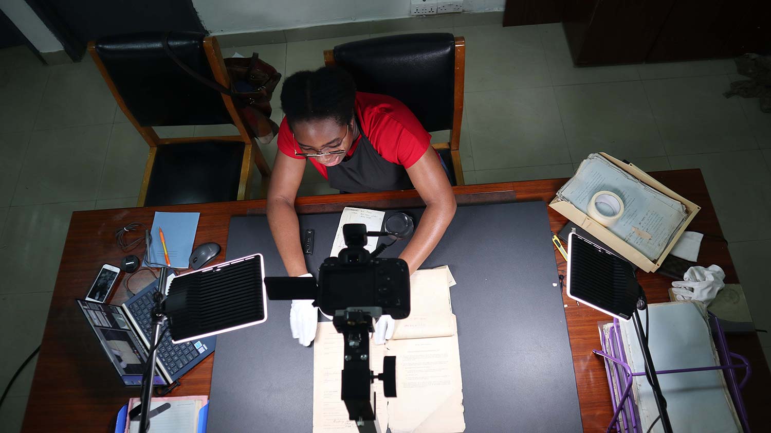
This project focuses on the digitization and preservation of endangered architectural records across Ghana. Supported by UCLA Modern Endangered Archives Program, the initiative seeks to make rare and historically significant materials—ranging from early 1900s building permits to contemporary planning documents—openly accessible and permanently preserved. As part of the Accra Archive Initiative, the project builds on earlier work documenting colonial-era architectural records from the Gold Coast period, expanding the archive to include over a century of material related to urban planning, land ownership, and the built environment. By transforming at-risk documents into a shared public resource, the project not only safeguards critical histories but also activates archives as tools for research and advocacy.
The Settler Colonial City Project is a research collective focused on the collaborative production of knowledge about cities on Turtle Island/Abya Yala/The Americas as spaces of ongoing settler colonialism, Indigenous survivance, and struggles for decolonization. The concept of “settler colonialism” has recently emerged as a name for a distinctive form of colonialism that develops in places where settlers permanently reside and assert sovereignty. While the settler colonial dimensions of American cities have been centered in contemporary urban activism, these dimensions have been, at best, only tentatively explored in contemporary architectural and urban studies. Investigating the settler colonial history and contemporaneity of cities on Turtle Island/Abya Yala/The Americas, we aim to foreground Indigenous knowledge of and politics around land, life, and collective futures, as well as settler colonialism as an unmarked structure for the distribution of land, possibilities of life, and imagination of those futures.
Mapping the Water Crisis maps and visualizes data to show how Detroit’s water shutoffs disproportionately affected Black neighborhoods and were linked to systemic racial and economic inequalities
Longer-Term Goals & Future Objectives
- Advancing design-driven approaches to spatial and housing justice through community-engaged, interdisciplinary research.
- Expanding the evidence base for non-speculative and collective models of land ownership and their role in equitable city-building.
- Developing tools, frameworks, and resources that place design and planning knowledge directly in the hands of community organizations and residents.
- Strengthening collaborations between architects, urban planners, public health researchers, legal scholars, and the communities most affected by spatial inequity.
- Supporting research that translates into policy, built projects, and publicly accessible tools with measurable real-world impact.
Publications
- Who walks most? Uncovering racial disparities in walking in the United States
- The race travel penalty for food shopping in metropolitan areas of the United States
- Between proximity and security: A log-linear choice modeling of displacement risks and residential mobility trade-offs in immigrant Sub-Saharan communities
- Under the Campus, the Land: Anishinaabe Futuring, Colonial Non-Memory, and the Origin of the University of Michigan
- The Global Shelter Imaginary: Ikea Humanitarianism and Rightless Relief


 Link copied